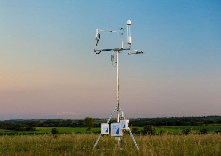

Mountain regions are among the areas most affected by climate change, experiencing faster warming, altered precipitation patterns, changing snow dynamics, and more intense extreme events. These changes directly influence both the water cycle and the carbon cycle, making it increasingly important to study and monitor natural and managed ecosystems in these areas.
Key Takeaways
- The regional network of Environmental Protection Agency of Aosta Valley (ARPA Valle d'Aosta) includes 9 monitoring sites along with three additional sites from other institutions. The network spans elevations from approximately 500 to 3,100 m and represents agricultural, forest, wetland, grassland, and high-altitude alpine environments.
- Seven evapotranspiration (ET) systems using the LI-710 Evapotranspiration Sensor complement long-term CO2/H2O flux measurements at two Integrated Carbon Observation System (ICOS)-associated sites that are equipped with LI-7200 and LI-7500 analyzers (Galvagno et al., 2026; Cremonese et al., 2026).
- Direct ET observations are helping refine irrigation and regional water-management strategies, while long-term CO₂ flux measurements support regional carbon-budget estimates.
- ARPA Valle d'Aosta estimates that regional ecosystems' capacity to offset anthropogenic CO₂ emissions is close to 70%, although that capacity is vulnerable to climate variability and extreme events.
Why Measure Evapotranspiration and Carbon Fluxes in Mountain Agroecosystems?
Regarding the water cycle, evapotranspiration (ET) is the second-largest component of the water cycle after precipitation and represents the pathway through which water is lost from terrestrial ecosystems to the atmosphere. ET measurements are essential for improving irrigation scheduling, optimizing water management, and supporting sustainable agriculture. For the carbon cycle, reliable estimates of ecosystem CO₂ uptake are fundamental for understanding ecosystem functioning and evaluating the contribution of forests and agricultural ecosystems toward regional climate mitigation targets and net-zero strategies.
Although both ET and carbon fluxes can be estimated using remote sensing, ecosystem models, and forest inventories, these approaches often struggle to capture the strong spatial and temporal variability and complex ecosystem responses typical of Alpine landscapes. Direct eddy covariance observations provide the most robust way to quantify these exchanges, offering continuous, ecosystem-scale measurements that improve both water resource management and regional carbon accounting.

New to eddy covariance?
Download the complete guideBuilding a Regional Eddy Covariance and Evapotranspiration Monitoring Network
Since 2008, ARPA Valle d'Aosta has progressively established a regional network dedicated to monitoring carbon and water ecosystem-atmosphere exchanges across the Aosta Valley in the northwestern Italian Alps.
The same observational infrastructure simultaneously supports two complementary objectives: improving estimates of actual evapotranspiration for agricultural water management and quantifying ecosystem carbon uptake to support regional climate policies. Flux measurements are integrated with satellite observations, meteorological data, and land-cover information to upscale local observations across the entire administrative region, enabling both regional ET assessments and carbon-budget estimation.
Expanding Evapotranspiration Monitoring Across 12 Sites in the Aosta Valley
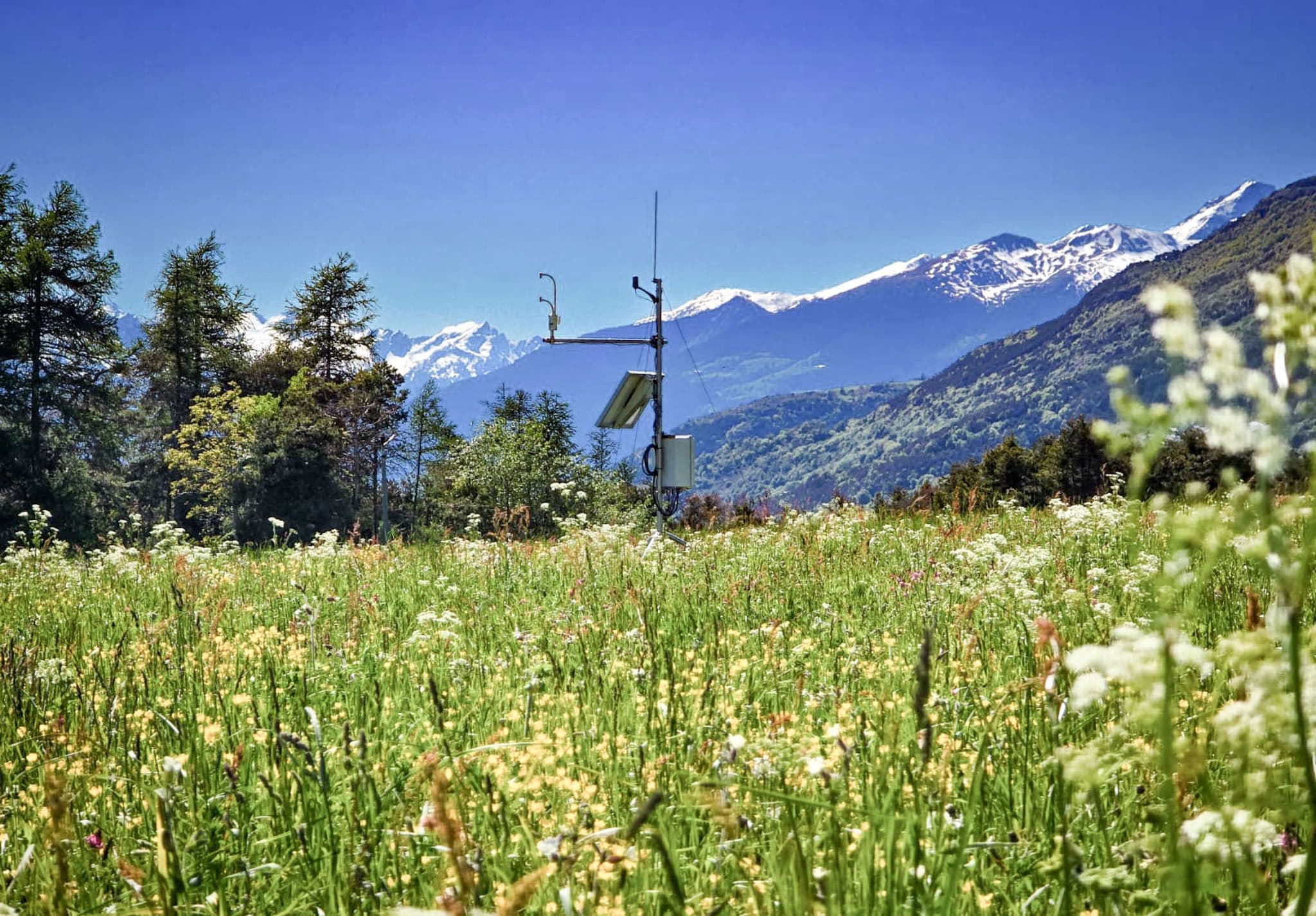
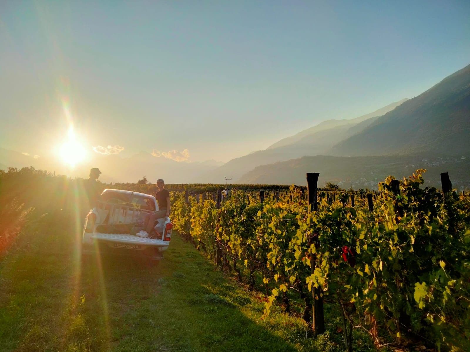
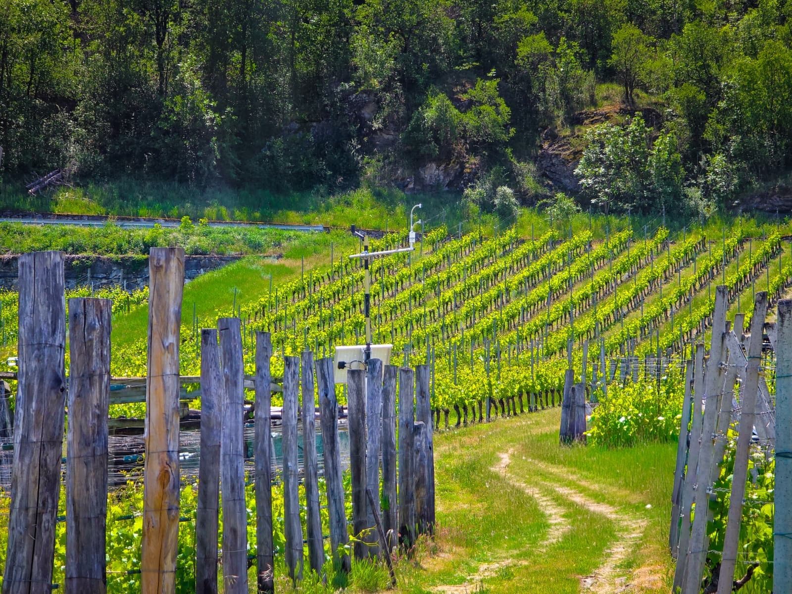
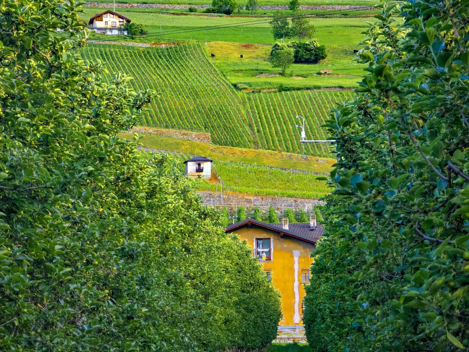
In 2025, through the Agile Arvier project (Next Generation EU), seven ET systems using the LI-710 Evapotranspiration Sensor were installed across representative agricultural ecosystems. These new measurements were integrated with long-term flux observations from two ICOS)-associated sites (IT-Tor and IT-TrF) that were equipped with LI-7200 Enclosed CO2/H2O Analyzers and LI-7500 Open Path CO2/H2O Analyzers. In addition, thanks to the collaboration with the University of Torino, the Institut Agricole Régional, and the Gran Paradiso National Park, the network also includes three additional ET systems. The resulting network comprises 12 monitoring sites spanning elevations from approximately 500 to 3,100 m above sea level—including vineyards, apple orchards, meadows, pastures, forests, wetlands, abandoned grasslands, and high-altitude alpine environments.
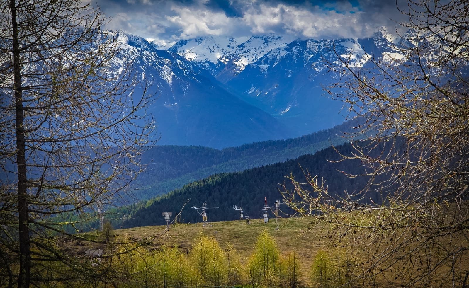
This initiative represents one example of how environmental monitoring can inform decision-making that balances nature conservation with key economic activities, such as viticulture, apple production, forestry, hydropower generation, and tourism. The initiative is carried out in close collaboration with local water managers, the regional administration, and the regional agriculture department, ensuring that these measurements are not only scientifically valuable but also translate into direct benefits for society, supporting more informed and sustainable water management, climate mitigation planning, and biodiversity conservation.

Building a multi-site flux network?
Watch this webinarImproving Irrigation Recommendations with Direct Evapotranspiration Measurements
Direct ET observations allowed site-specific comparisons with the regional Irrigation Water Requirement (IWR) project that was developed by ARPA Valle d'Aosta and the CIMA Foundation, which improved irrigation recommendations based on measured rather than modeled water use. These data are helping refine regional water management strategies while providing insight into ecosystem responses to drought and changing climatic conditions.
Looking to monitor actual ET in real time?
Watch this webinarUsing Long-Term CO₂ Flux Measurements to Estimate a Regional Carbon Budget
At the same time, long-term eddy covariance CO₂ measurements have enabled the development of a regional carbon budget for the Aosta Valley. By combining flux observations with satellite vegetation indices, meteorological data, and machine-learning models, ARPA Valle d'Aosta estimated that the ecosystems’ capacity to offset anthropogenic CO₂ emissions in the region is close to 70%, although this capacity is vulnerable to climate variability and extreme events.
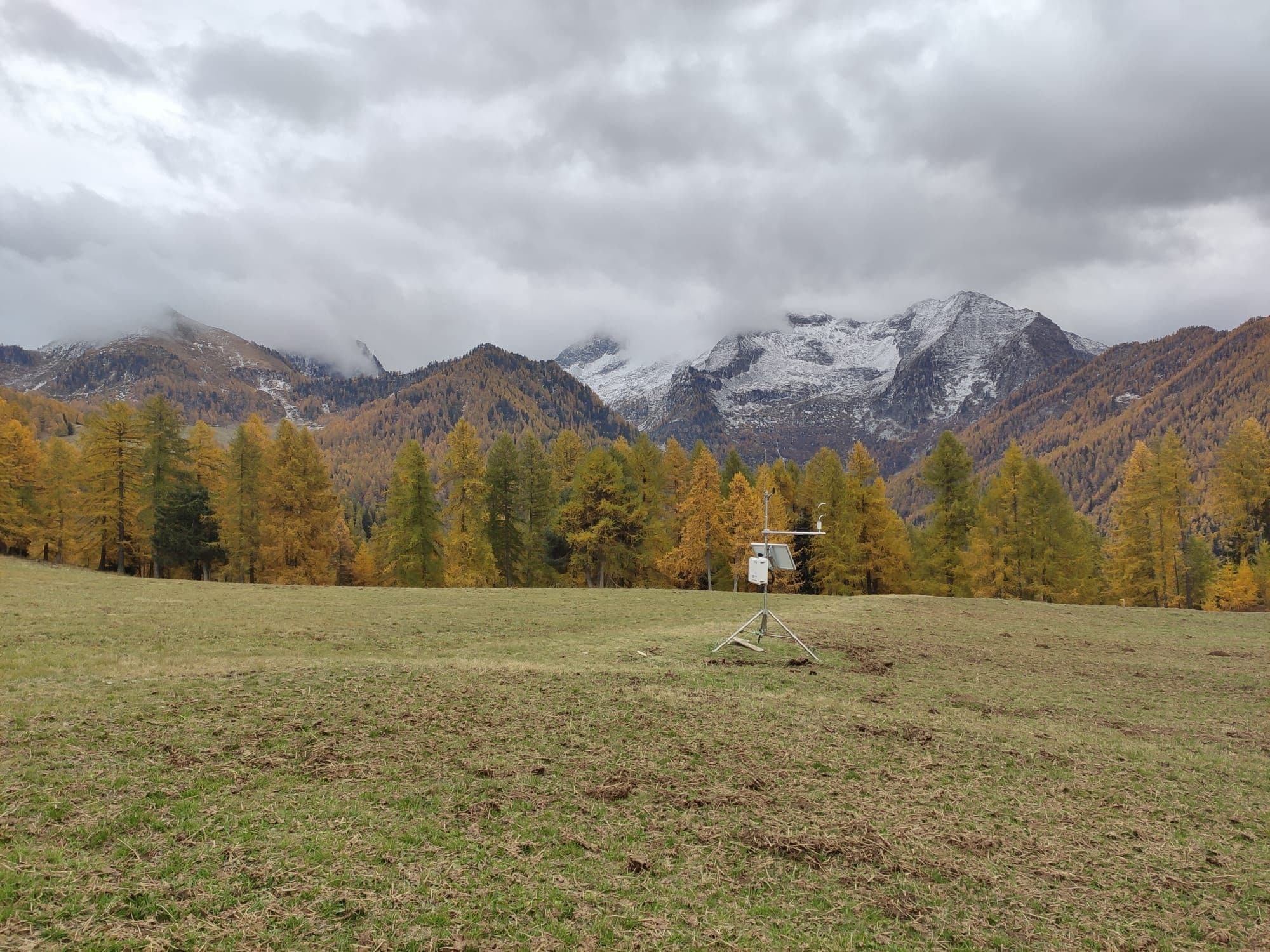
Connecting Water and Carbon Flux Monitoring for Climate Adaptation and Mitigation
The integration of water and carbon flux measurements offers a comprehensive picture of ecosystem functioning, illustrating how the same observational network supports both climate adaptation and mitigation. A key next step is the release of an online, open-access ET database, which will allow researchers, farmers, sector experts, and policymakers to access and download the data.
The plots below show the evolution of ET during 2026 across different types of agricultural and semi-natural ecosystems in the Aosta Valley network. Overall, 2026 has been a particularly dry year with water availability becoming an important constraint on ecosystem functioning and crop water use.
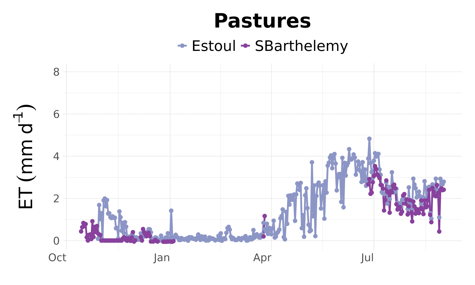
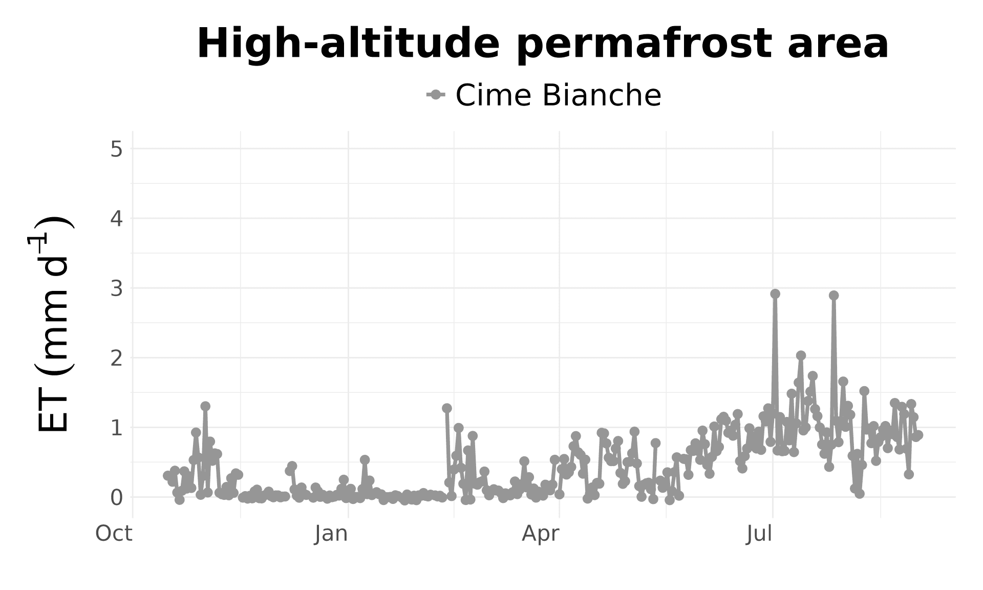
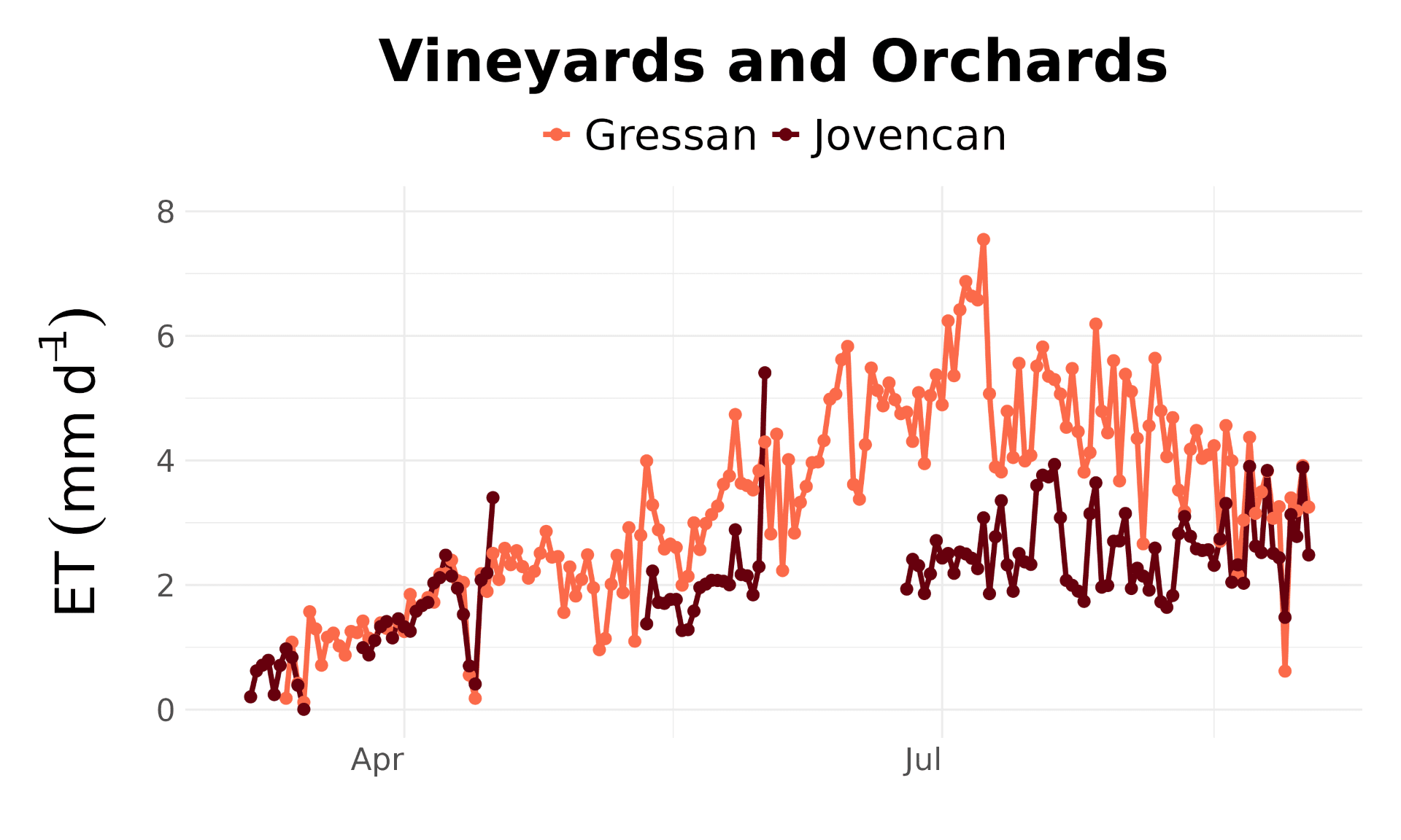
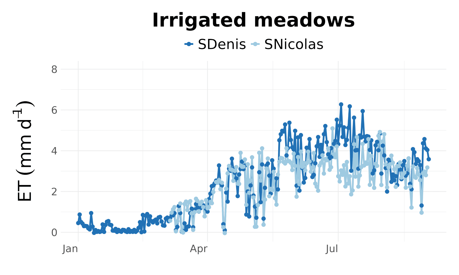
Together, these measurements connect long-term ecosystem research with practical regional decision-making. By pairing evapotranspiration measurements with CO₂ flux monitoring, satellite observations, meteorological data, and regional modeling, ARPA Valle d'Aosta can better understand water use, ecosystem carbon uptake, and climate responses across a diverse mountain landscape. As the network develops and more data become available, these observations can continue to support both scientific research and regional water and climate planning.
Follow ARPA Valle d’Aosta
Stay up to date on ARPA Valle d'Aosta's work and find additional information on the region's 2026 water and carbon data.
LEARN MORE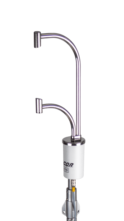
Start Measuring Actual ET
Explore how the LI-710 Evapotranspiration Sensor and Water Node provide direct measurements of actual evapotranspiration for agricultural, water-resource, and environmental monitoring applications.
LEARN MOREReferences
Galvagno, M., Koliopoulos, S., Guarnieri, C., Filippa, G., Avanzi, F., Ferraris, D., Tagliaferro, F., Chabloz, D., Cremonese, E., Ferraris, S., Lodigiani, M., Mainetti, A., Nicora, M., and Pogliotti, P.: A regional evapotranspiration network for climate-resilient water management in mountain agro-ecosystems, EGU General Assembly 2026, Vienna, Austria, 3–8 May 2026, EGU26-10299, https://doi.org/10.5194/egusphere-egu26-10299, 2026.
Galvagno, M., Filippa, G., Tuzzi, L., Cremonese, E., Collalti, A., Colombo, R., Dalmonech, D., Grassi, G., Migliavacca, M., Tomelleri, E., and Nelson, J.: Empowering local Climate Change mitigation policies through Eddy Covariance flux measurements, EGU General Assembly 2024, Vienna, Austria, 14–19 Apr 2024, EGU24-12677, https://doi.org/10.5194/egusphere-egu24-12677, 2024.
Cremonese, E., Galvagno, M., Morra di Cella, U. (2026). ETC L2 Fluxes from Torgnon, 2007-12-31–2025-12-31, ICOS RI. https://hdl.handle.net/11676/l60S86cKOvgtzSp1FBzR2zNv
Galvagno, M., Ferraris, D., Filippa, G. (2026). ETC L2 ARCHIVE from Torgnon-LD, 2012–2025, ICOS RI. https://hdl.handle.net/11676/SEktvYFYP3yhQE7SEjkMsMVd
About the Author
Marta Galvagno is a biometeorologist at the Environmental Protection Agency of Aosta Valley, Italy, within the Climate Change and Environmental Sustainability Group. Her research focuses on the functioning of terrestrial ecosystems and their responses to climate change and extreme events, with a focus on carbon and water fluxes at the biosphere-atmosphere interface. She is principal investigator of two ICOS-associated stations, a mountain grassland and a European larch forest, and her research combines eddy covariance observations with eco-physiological measurements, remote sensing, and modelling. Her work involves providing technical support to the Regional Administration, local policymakers, and farmers in the development of climate change mitigation and adaptation strategies, water management and irrigation planning, and the assessment of the land use, land-use change, and forestry (LULUCF) sector at the regional level.
NEVER MISS OUT ANOTHER POST
SUBSCRIBE TO OUR NEWSLETTERJOIN OUR COMMUNITY TODAY!